
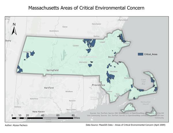
Areas of Critical Environmental Concern (ACEC) Analysis
The goal of the project is to explore ACEC distribution, acreage, and designation trends across the state, providing insights to support conservation planning and environmental awareness. Code and charts are maintained on GitHub (https://github.com/AlyssaPacheco2721/Massachusetts-acec)